
Here are some example maps made from the database, calculated from the distribution maps in AFE 1–11:
- Number of families per square
- Number of native families per square
- Number of alien families
- Number of genera
- Number of species
- Number of native species
- Number of established aliens (species)
- Number of possibly extinct or extinct species
- Proportion of native and present species vs. all species
- Proportion of established aliens, species with unknown status, possibly extinct, extinct or uncertain vs. number of native and present species
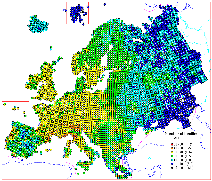
Fig. 1. Number of families per square.
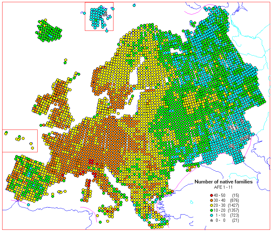
Fig. 2. Number of native families per square.
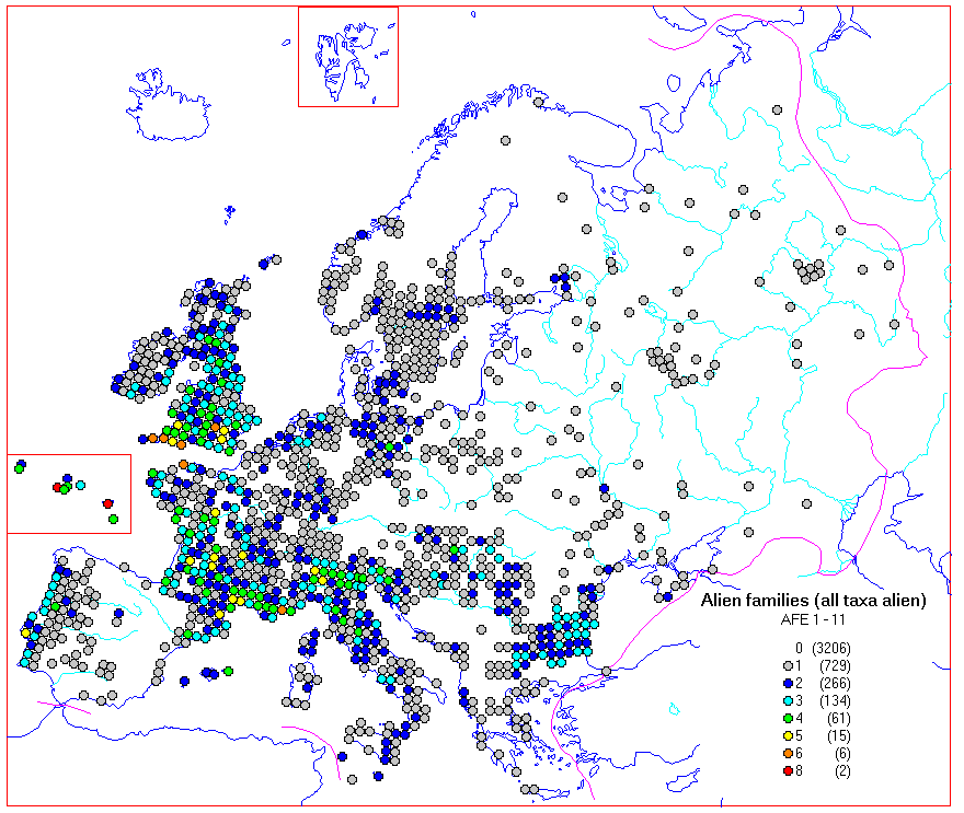
Fig. 3. Number of alien families.
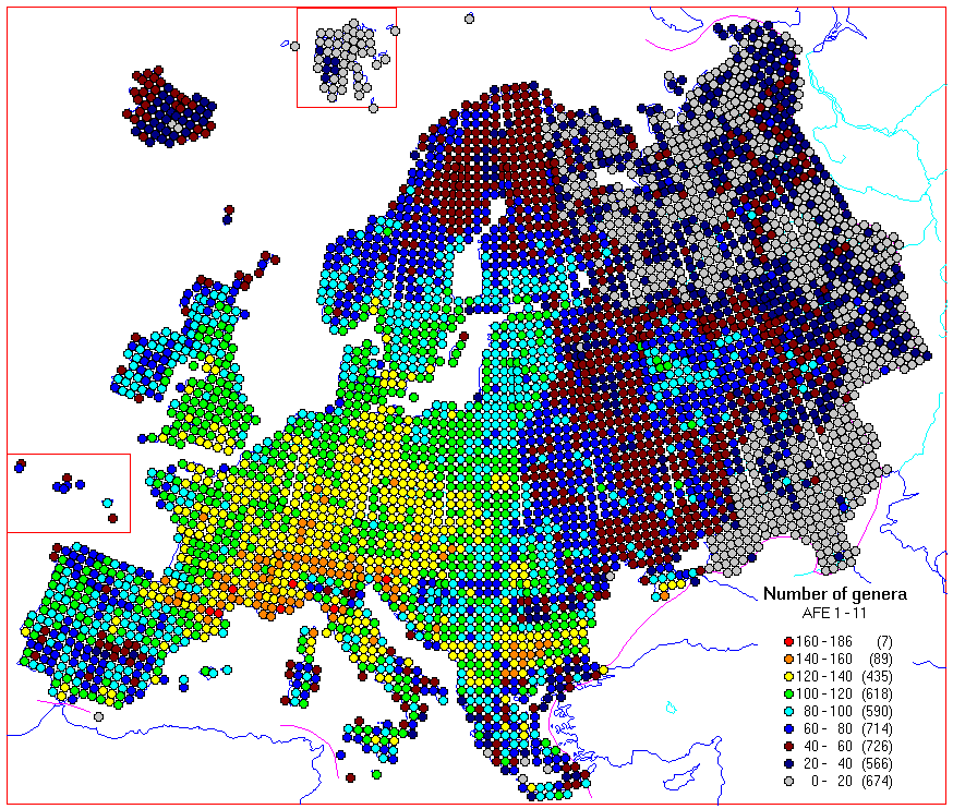
Fig. 4. Number of genera.
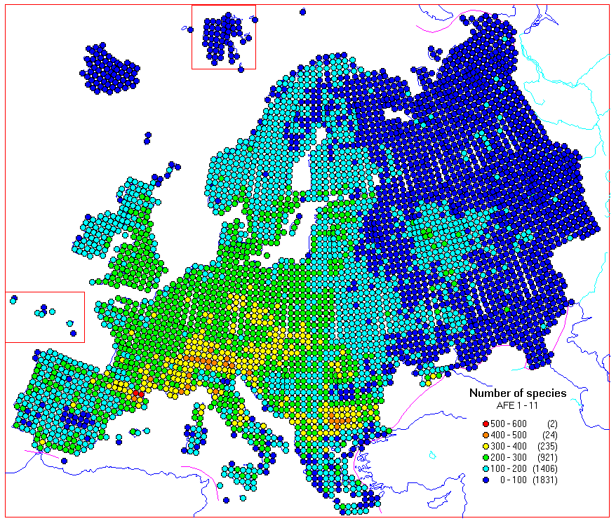
Fig. 5. Number of species.
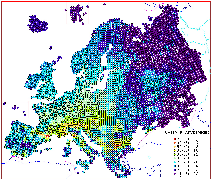
Fig. 6. Number of native species.
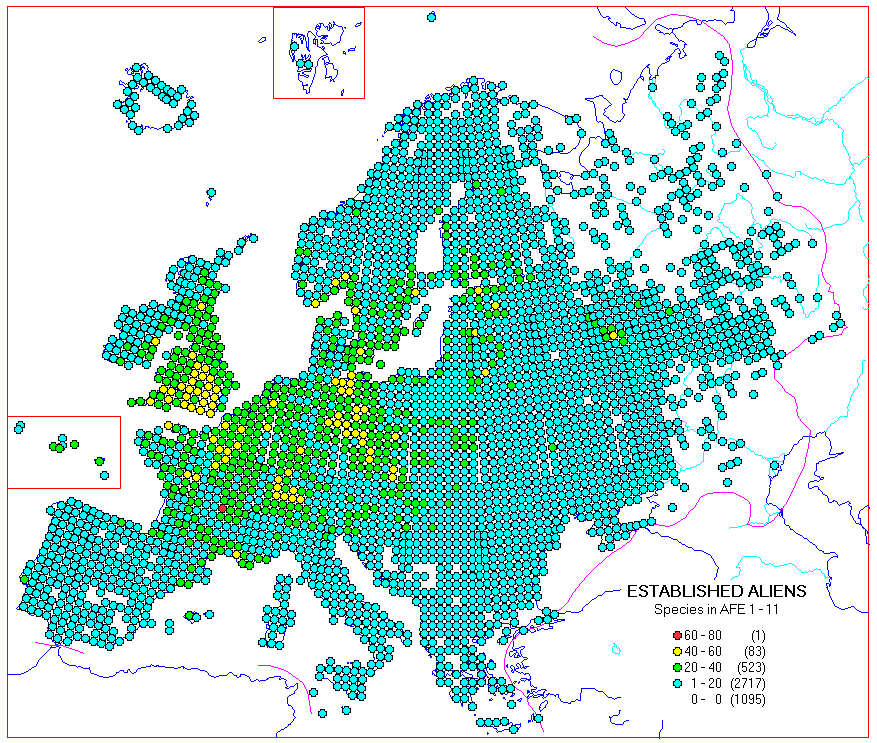
Fig. 7. Number of established aliens (species).
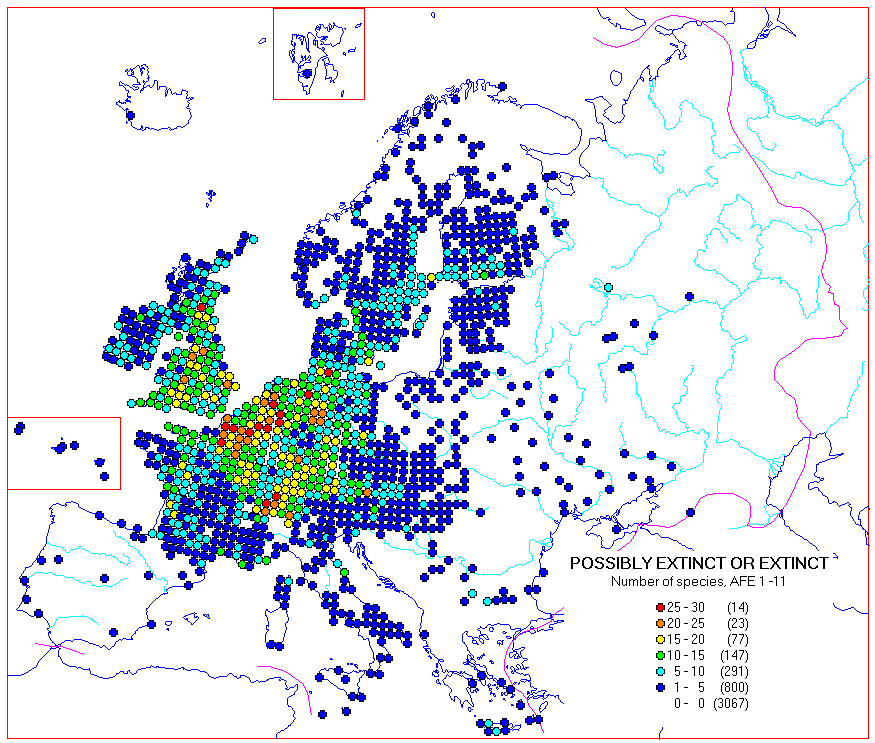
Fig. 8. Number of possibly extinct or extinct species.
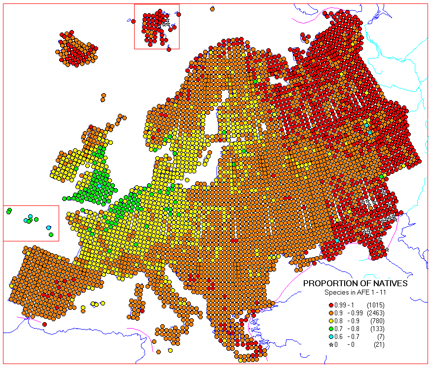
Fig. 9. Proportion of native and present species vs. all species.
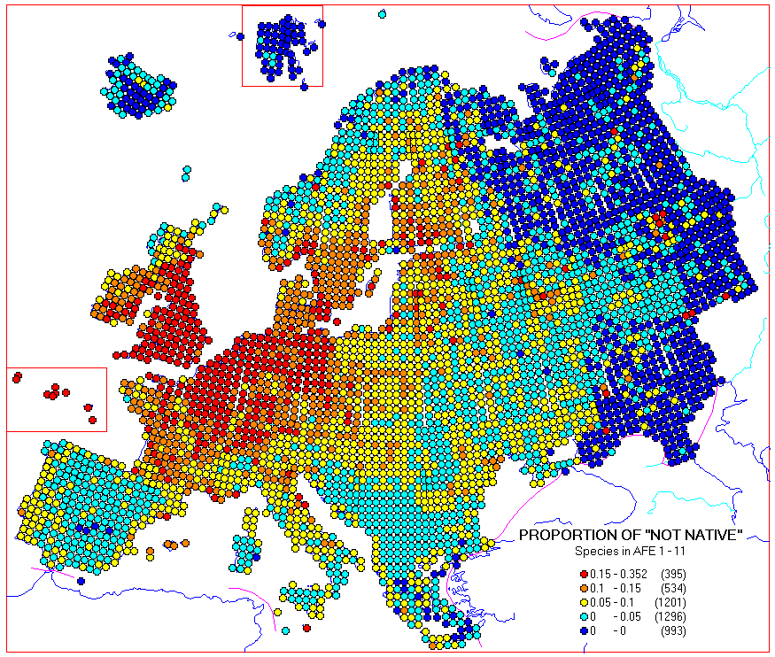
Fig. 10. Proportion of established aliens, species with unknown status, possibly extinct, extinct or uncertain vs. number of native and present species.